When a lost hiker is still alive after nearly a week in steep, creek-cut canyons, the outcome is not luck; it is the product of disciplined search planning, interagency coordination, and the simple physics of survival—water, shelter, and time—working just long enough to meet a helicopter hoist.
At a Glance
- A 72-year-old Siskiyou County woman was found alive after an estimated five to seven days in rugged country straddling the Shasta–Siskiyou line.
- Her vehicle’s discovery triggered a joint, multi-day search using ground teams, dog units, dirt riders, and a Jeep team.
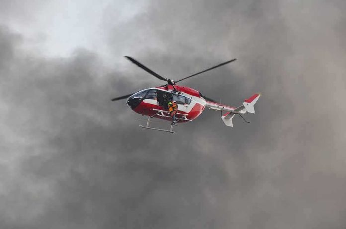
- A California Highway Patrol aircrew executed a hoist extraction and flew her to a hospital with injuries and exposure signs consistent with prolonged wilderness survival.
- Extended survivals are uncommon; most lost hikers are found within 24 hours, which is why weeklong cases stand out.
What Happened: A rare long-duration rescue in steep canyon terrain
Shasta County Search and Rescue reported that a Siskiyou County ground team located a 72-year-old woman alive with injuries and clear signs of exposure in difficult country marked by creeks, trails, dirt roads, and narrow shelf paths near the counties’ border. The estimate is stark: five to seven days alone before discovery. The operational trigger was her vehicle; once the Siskiyou County Sheriff’s Office found it near the line, a cross-county search spun up, deploying dog teams, ground crews, dirt riders, and a Jeep team to saturate the canyons and corridors people tend to follow when lost. Once pinned down, the California Highway Patrol hoisted her out and flew her to a hospital for definitive care.
That sequence—a vehicle locate, a methodical search grid built around likely human movement, and an aviation hoist for the extraction—is textbook for wilderness incidents complicated by broken terrain. The woman’s injuries and exposure match what field medics expect after days outside: dehydration graded by mentation and vitals, soft-tissue trauma from falls or brush, and thermoregulatory strain, even in shoulder seasons when daytime warmth hides nighttime risk.
How These Searches Work: Behavior, probability, and terrain corridors
Search leaders start with two anchors: last known position (LKP) and point last seen (PLS). A parked vehicle at a trailhead or backroad is often the best LKP they’ll get. From there, they model lost person behavior—patterns repeatedly borne out in U.S. SAR data—prioritizing terrain features that attract or channel movement: trails, roads, ridges, low points, and stream courses. That is why dog teams and off-road-capable units are paired with foot teams; the goal is to cover the highest-probability corridors quickly, then expand.
Contrary to the drama of weeklong epics, most searches resolve fast. Backcountry SAR practitioners commonly report that a large majority of lost people are found within 12 hours, and very few push beyond 24 hours—long-duration survivals are statistical outliers, which is precisely why they make news. Knowing that baseline helps commanders calibrate resources: early hours demand speed over comprehensiveness; later phases add methodical gridding and specialty assets. An air hoist, when it appears, is not spectacle—it is the safest, fastest way to extract a compromised patient from slopes or gulches where a carryout would risk further harm and cost irreplaceable hours.
Why This One Stood Out: Duration, age, and canyon microclimates
Surviving five to seven days at age 72 in canyon terrain suggests a handful of mechanisms aligned. First, water access: creeks in steep drainages provide intermittent hydration, which is far more critical than food in the first week. Second, microclimate: canyon bottoms can be cooler by day and colder by night; shade, wind breaks, and even simple overhangs or brush piles reduce radiant and convective heat loss—small edges that compound over time. Third, self-limiting movement: after an injury or navigational error, many survivors adopt a shelter-in-place pattern near water or a visible feature, increasing the chance a line search will intersect them. Those tendencies are exactly what SAR planners bank on when they flood riparian corridors and trail networks first.
Age changes the calculus but not the fundamentals. Thermoregulation can be less efficient, and musculoskeletal injuries take a larger toll; yet older hikers often carry decades of judgment that keeps panic in check. In the field, a calm, stationary subject near water is easier to find and easier to stabilize than a dehydrated wanderer crossing ridges at random. That difference is the margin between a walkout, a rescue, and a recovery—a triad California agencies use to classify outcomes.
The Coordination Piece: Why interagency searches succeed
County lines in California are administrative; the mountains do not care. Once Siskiyou deputies tied the subject’s vehicle to the area, Shasta County SAR’s rapid integration brought scale: scent-specific K9s to work likely travel paths, off-highway teams to cover distance quickly, and ground units to probe drainages and shelf trails where a misstep can become an immobilizing fall. Aviation is the capstone asset; when the California Highway Patrol sends a ship with a hoist, crews can move a patient from ledge to litter to aircraft in minutes, bypassing hours of rope work and rough carries that degrade both patient and rescuers.
These operations rely on quiet logistics: radio interoperability, common map products, and a shared picture of assignments and clearance. Good search work looks like patience from the outside; inside the command post, it’s probability math, team safety margins, duty-hour limits, and the relentless discipline of checking boxes line by line until someone calls out, “Contact.”
Where This Fits in the Larger Pattern
The Yosemite incident record and backcountry SAR reporting converge on a simple truth: missing hikers drive a majority of wilderness SAR calls, but most resolve quickly and close to linear features—trails, roads, ridgelines, and streams. The cases that last several days are few; their very rarity is why they draw cameras and clicks. If you let those outliers define your risk model, you misread both the usual speed of resolution and the best prevention strategies.
The prevention logic is durable. Share a trip plan. Carry redundant navigation and a light. Pack a heat source and an insulating layer even on bluebird days. Above all, carry water and the means to treat more—filter, chemical tabs, or both. If you are lost or injured and not in immediate danger from weather or terrain, stop, shelter, and make yourself visible; you want to become a stationary problem at a predictable place near a resource, not a moving target that defeats the search plan.
Missing 72-year-old hiker beats the odds and survives a harrowing week alone in unforgiving California wilderness https://t.co/gDZF4vEafT pic.twitter.com/umde1WV2Xv
— New York Post (@nypost) October 7, 2026
The Takeaway: Survival buys time; good searching spends it well
The Shasta–Siskiyou rescue worked because two timelines converged: a subject who, despite age and injury, remained alive in terrain that offered water and cover, and a search that expanded intelligently from the vehicle outward, saturating the corridors humans favor until a team made contact and a hoist sealed the outcome. Extended survivals like this are exceptions, not expectations. But they are instructive; they teach what matters when the trail gives way to chance—water over food, shelter over miles, calm over haste—and they reaffirm why professional, well-coordinated search systems exist at all.
Sources:
nypost.com, krcrtv.com, abc7.com, siskiyou.news, nbcbayarea.com